Central Alabama at risk for severe storms late Friday, early Saturday
Published 3:30 pm Thursday, March 23, 2023
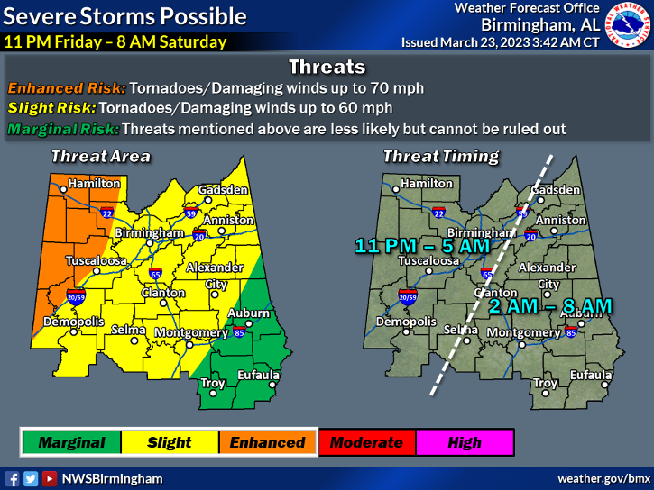
- The National Weather Service has placed St. Clair County in a level two out of five risk for severe storms.
PELL CITY — St. Clair County is at a slight risk for tornadoes and damaging straight line winds late Friday night and into early Saturday morning.
The National Weather Service (NWS) office in Calera has placed St. Clair County in a level two out of five risk for severe storms. The “slight” risk area encompasses most of central Alabama, and parts further west are under a higher “enhanced” risk area.
The main threat, according to the NWS, is from possible tornadoes and damaging winds up to 60 mph. No hail threat is forecast as of Thursday afternoon. The main timing for the threat begins around 11 p.m. Friday, for the western portions of the county and could continue until 5 a.m., or later, Saturday.
According to Mark Linhares, a meteorologist with the NWS office in Calera, residents should take the time before the storm to prepare.
“With this being an overnight event, we want to remind people that it is always a good idea to have multiple ways to receive warnings,” Linhares said. “Whether it is a weather radio or a cell phone, just have multiple ways to receive those warnings.”
Linhares also suggested that residents check reliable sources, like local news or weather accounts on social media, before going to bed Friday night, to see if the timing or severity of the storms have changed.
After Friday and Saturday, another chance of rain and storms could be possible Sunday evening, but Linhares said the event was too far out to give specifics, but the threat should stay south of the Interstate 20 corridor.
