Hurricane Irma potential impact on St. Clair County
Published 8:26 am Sunday, September 10, 2017
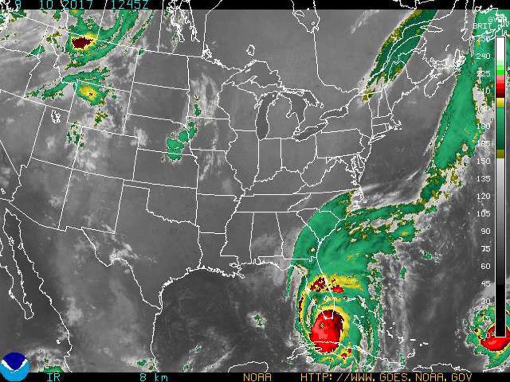
- A Tropical Storm Warning has been issued for Eastern Alabama, including St. Clair County. Satellite image of Hurricane Irma from the National Weather Service.
The National Weather Service has issued a Tropical Storm Warning that will impact St. Clair County and surrounding areas in East Alabama within the next 36 hours, bringing Tropical Storm wind conditions with sustained wind at 30-40 mpg and gusts up to 60 mph.
Strongest wind gusts are expected Monday afternoon until Tuesday morning.
Trending
LOCATIONS AFFECTED – Pell City – Moody; surrounding areas in East Alabama and St. Clair County
WIND – LATEST LOCAL FORECAST:
Equivalent Tropical Storm force wind. Peak Wind Forecast: 30-40 mph with gusts to 60 mph Window for Tropical Storm force winds: Monday afternoon until early Tuesday morning
CURRENT THREAT TO LIFE AND PROPERTY: Elevated
The wind threat has remained nearly steady from the previous assessment. Emergency plans should include a reasonable threat for tropical storm force wind of 39 to 57 mph. To be safe, prepare for the potential of limited wind impacts. Remaining efforts to secure properties should now be brought to completion. Hazardous wind is possible. Failure to adequately shelter may result in serious injury. Move to safe shelter before the wind becomes hazardous.
POTENTIAL IMPACTS: Limited
Damage to porches, awnings, carports, sheds, and unanchored mobile homes may be possible. Unsecured lightweight objects can be blown about. Many large tree limbs could be broken off. A few trees snapped or uprooted, but with greater numbers in places where trees are shallow rooted. Some fences and roadway signs blown over. A few roads could be impassable from debris, particularly within urban or heavily wooded places. Hazardous driving conditions on bridges and other elevated roadways. Scattered power and communications outages.
FLOODING RAIN – LATEST LOCAL FORECAST:
Peak Rainfall Amounts: 2-4 inches, with locally higher amounts.
CURRENT THREAT TO LIFE AND PROPERTY: Elevated
The flooding rain threat has remained nearly steady from the previous assessment. Emergency plans should include a reasonable threat for minor flooding where peak rainfall totals are near amounts conducive for localized flash flooding and rapid inundation. To be safe, prepare for the potential of limited flooding rain impacts. Localized flooding is possible. If flood related watches and warnings are issued, heed recommended actions.
POTENTIAL IMPACTS: Limited
Localized rainfall flooding may prompt a few evacuations. Rivers and tributaries may quickly rise with swifter currents. Small streams, creeks, canals, arroyos, and ditches may become swollen and overflow in spots. Flood waters can enter a few structures, especially in usually vulnerable spots. A few places where rapid ponding of water occurs at underpasses, low-lying spots, and poor drainage areas. Several storm drains and retention ponds become near-full and begin to overflow. Some brief road and bridge closures.
TORNADO – LATEST LOCAL FORECAST: – Situation is unfavorable for tornadoes
CURRENT THREAT TO LIFE AND PROPERTY: None
The tornado threat has remained nearly steady from the previous assessment. Emergency plans need not include a threat for tornadoes. Showers and thunderstorms with strong gusty winds may still occur. Little to no preparations needed to guard against tropical tornadoes. Ensure readiness for the next tropical tornado event.
POTENTIAL IMPACTS: Little to None
Little to no potential impacts from tornadoes.
FOR MORE INFORMATION:
Visit http://www.ready.gov/hurricanes, have your weather radio, or visit www.weather.gov