EMA: Beware of strong storms this weekend
Published 12:15 pm Friday, December 11, 2015
- From the National Weather Service.
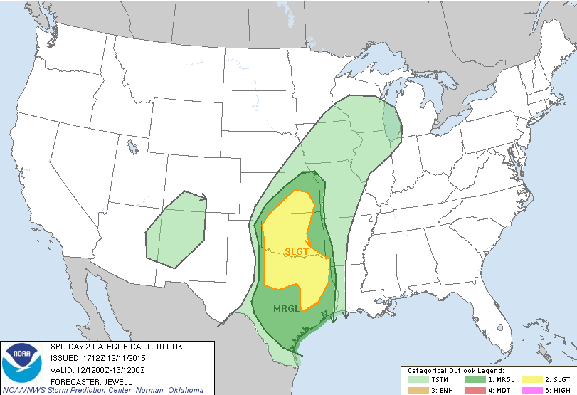
The National Weather Service in Birmingham is warning the area of a line of threatening storms moving in this weekend.
Friday morning, NWS reported it was tracking a strong storm system that will track eastward across the Gulf Coast region late this weekend. The St. Clair County Emergency Management Agency predicted today that the Squall line (if one forms) should approach the I-65 corridor by midnight Sunday, Dec. 13.
Trending
“There is a limited threat of damaging winds and isolated tornadoes across western portions of Central Alabama, generally along and west of a line from Sulligent to Tuscaloosa to Lowndesboro Sunday evening into Early Monday morning,” NWS released. “The current forecast indicates that the Threats could begin as early as 7 p.m. Sunday evening and last as late as 3 a.m. Monday morning.
“There are still some uncertainties in the strength and severity of the system as it moves across the state. More specific and detailed information on timing and affected area will be forthcoming as we get closer to the event.”
NWS also warned of gusty winds ahead of the storm. The highest winds will likely be just ahead of the squall line. Southerly wind gusts of 30-35 mph may be possible, which could down small or weak trees dbfore the line of storms arrives.
For more, call the EMA at 205-884-6800.

